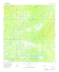
1954 Map of Medfra A-3
USGS Topo · Published 1977About this map
Nikolai serves as a primary point of human activity along the Kuskokwim River, featuring a designated Landing Strip and several Cabins that illustrate the necessity of aviation and river transport in this interior Alaskan landscape. The complex hydrology of the region is defined by the convergence and meandering paths of the North Fork Kuskokwim River and the East Fork Kuskokwim River, which navigate a low-lying terrain filled with prominent water bodies like Reed Lake and Fish Lake. A network of seasonal transport is visible via the Winter Trail, reflecting how the landscape was navigated during the mid-century era. To the east, the elevation rises toward the Hills, providing a stark contrast to the lake-strewn flats of the river valley near Jones Creek and Salmonberry Lake.
Find a feature on this map
20 named features on this map. Tap any name to fly to it.
Don’t see what you’re looking for? This feature index may not catch every label — zoom into the map to look around manually.
Map Details
Editions of this 1954 Medfra A-3 Map
2 editions found
Other maps of this area

1949 · McGrath
USGS Topo · 1:250,000

1950 · Medfra
USGS Topo · 1:250,000

1950 · McGrath
USGS Topo · 1:250,000

1953 · McGrath D-4
USGS Topo · 1:63,360

1953 · Medfra B-4
USGS Topo · 1:63,360

1954 · McGrath D-3
USGS Topo · 1:63,360

1954 · Medfra A-3
USGS Topo · 1:63,360

1955 · Medfra B-3
USGS Topo · 1:63,360

1958 · McGrath D-2
USGS Topo · 1:63,360

1958 · Medfra A-2
USGS Topo · 1:63,360