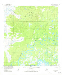
1959 Map of Medfra A-4
USGS Topo · Published 1973About this map
Medfra sits at a strategic bend in the Kuskokwim River, serving as a vital node in the interior Alaska river network during the mid-20th century. The settlement’s connectivity is underscored by a landing strip and a network of pathways, including a Winter Trail and a standard Trail that cut across the lowlands. The landscape is dominated by the complex hydrology of the Kuskokwim and its tributaries, such as the North East Fork and South Fork, which create a labyrinth of oxbow lakes and sloughs across the valley floor.
Find a feature on this map
32 named features on this map. Tap any name to fly to it.
Don’t see what you’re looking for? This feature index may not catch every label — zoom into the map to look around manually.
Map Details
Editions of this 1959 Medfra A-4 Map
2 editions found
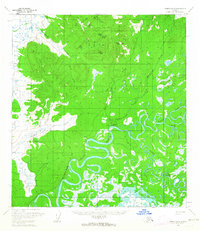
Other maps of this area

1949 · McGrath
USGS Topo · 1:250,000

1950 · Medfra
USGS Topo · 1:250,000

1950 · McGrath
USGS Topo · 1:250,000

1953 · McGrath D-5
USGS Topo · 1:63,360

1953 · McGrath D-4
USGS Topo · 1:63,360

1953 · Medfra B-4
USGS Topo · 1:63,360

1953 · Medfra B-5
USGS Topo · 1:63,360

1954 · Medfra A-5
USGS Topo · 1:63,360

1954 · McGrath D-3
USGS Topo · 1:63,360

1954 · Medfra A-3
USGS Topo · 1:63,360