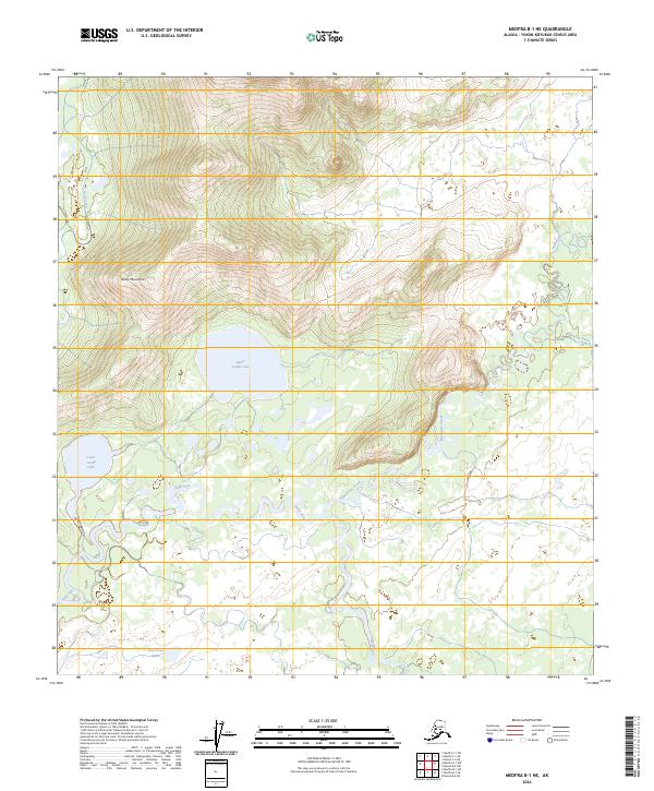
2024 Map of Medfra B-1 NE
USGS Topo · Published 2024About this map
The Telida Mountains dominate the central landscape of this interior Alaska region, where the terrain transitions into a complex system of glacial and alluvial water bodies. To the west, the interconnected Upper Telida Lake and Lower Telida Lake provide a significant geographical anchor, while the southern reaches are marked by the presence of Tonel'ono' Mina'. This area is defined by its intricate drainage patterns, with the Swift Fork and Highpower Creek winding through the lowlands before meeting the Shishona River in the east. The map illustrates a remote wilderness environment where water and elevation dictate the character of the land, showing how the Red Slough and various tributaries navigate the flats beneath the mountain slopes.
Find a feature on this map
15 named features on this map. Tap any name to fly to it.
Don’t see what you’re looking for? This feature index may not catch every label — zoom into the map to look around manually.
Map Details
Editions of this 2024 Medfra B-1 NE Map
This is the sole edition of this map. No revisions or reprints were ever made.
Other maps of this area

1950 · Medfra
USGS Topo · 1:250,000

1952 · Mount McKinley
USGS Topo · 1:250,000

1958 · Medfra C-1
USGS Topo · 1:63,360

1958 · Mount McKinley B-6
USGS Topo · 1:63,360

1958 · Mount McKinley C-6
USGS Topo · 1:63,360

1958 · Mount McKinley
USGS Topo · 1:250,000

1958 · Medfra B-1
USGS Topo · 1:63,360

1959 · Medfra
USGS Topo · 1:250,000

1969 · Mount McKinley
USGS Topo · 1:250,000
2017 · Denali B-6 SW
USGS Topo · 1:25,000