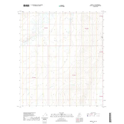
2019 Map of Medfra C-1 NE
USGS Topo · Published 2019About this map
The North Fork Kuskokwim River meanders across the northwestern corner of this interior Alaska landscape, defining a low-lying basin characterized by complex hydrological patterns. This 2019 survey documents a wilderness area where drainage is primarily facilitated by seasonal tributaries like Edaburge Cr and Medicineman Cr. To the east, the terrain rises sharply toward the prominence of Munsatli Ridge, which marks a significant topographical shift from the river valley to higher elevations. The map reveals the stark natural divisions of the Yukon-Koyukuk region, where the only human-imposed structure is the rigid grid of the Public Land Survey System. The absence of roads or permanent settlements emphasizes the environmental character of the territory as it existed in the early 21st century, centered on the Fish Cr drainage and the surrounding ridges.
Find a feature on this map
12 named features on this map. Tap any name to fly to it.
Don’t see what you’re looking for? This feature index may not catch every label — zoom into the map to look around manually.
Map Details
Editions of this 2019 Medfra C-1 NE Map
This is the sole edition of this map. No revisions or reprints were ever made.
Other maps of this area

1950 · Medfra
USGS Topo · 1:250,000

1952 · Mount McKinley
USGS Topo · 1:250,000

1958 · Medfra C-1
USGS Topo · 1:63,360

1958 · Medfra D-1
USGS Topo · 1:63,360

1958 · Mount McKinley D-6
USGS Topo · 1:63,360

1958 · Mount McKinley C-6
USGS Topo · 1:63,360

1958 · Mount McKinley
USGS Topo · 1:250,000

1959 · Medfra
USGS Topo · 1:250,000

1969 · Mount McKinley
USGS Topo · 1:250,000
2017 · Denali D-6 SW
USGS Topo · 1:25,000