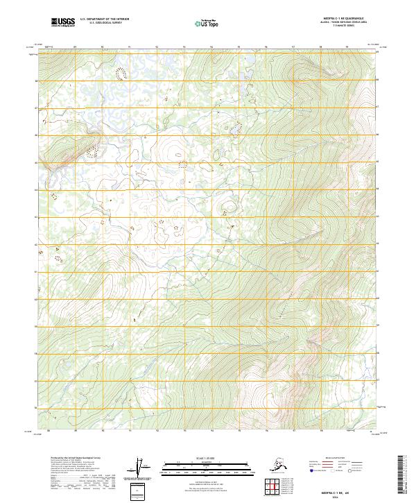
2024 Map of Medfra C-1 NE
USGS Topo · Published 2024About this map
The North Fork Kuskokwim River meanders through a landscape of wetlands and complex drainage patterns in this remote region of the Yukon-Koyukuk Census Area. The river's winding oxbows and bifurcated channels dominate the northwestern quadrant, giving way to the prominent elevation of Munsatli Ridge in the southeast. This topographical transition from low-lying riparian zones to significant upland terrain is bridged by several drainage systems, including Medicineman Creek and Edaburge Creek. The map details the unpopulated interior of Alaska, where the natural hydrology of Fish Creek and the surrounding wilderness remain largely untouched by modern infrastructure or permanent settlements, preserving a snapshot of the subarctic environment as it remains in the early 21st century.
Find a feature on this map
12 named features on this map. Tap any name to fly to it.
Don’t see what you’re looking for? This feature index may not catch every label — zoom into the map to look around manually.
Map Details
Editions of this 2024 Medfra C-1 NE Map
This is the sole edition of this map. No revisions or reprints were ever made.
Other maps of this area

1950 · Medfra
USGS Topo · 1:250,000

1952 · Mount McKinley
USGS Topo · 1:250,000

1958 · Medfra C-1
USGS Topo · 1:63,360

1958 · Medfra D-1
USGS Topo · 1:63,360

1958 · Mount McKinley D-6
USGS Topo · 1:63,360

1958 · Mount McKinley C-6
USGS Topo · 1:63,360

1958 · Mount McKinley
USGS Topo · 1:250,000

1959 · Medfra
USGS Topo · 1:250,000

1969 · Mount McKinley
USGS Topo · 1:250,000
2017 · Denali D-6 SW
USGS Topo · 1:25,000