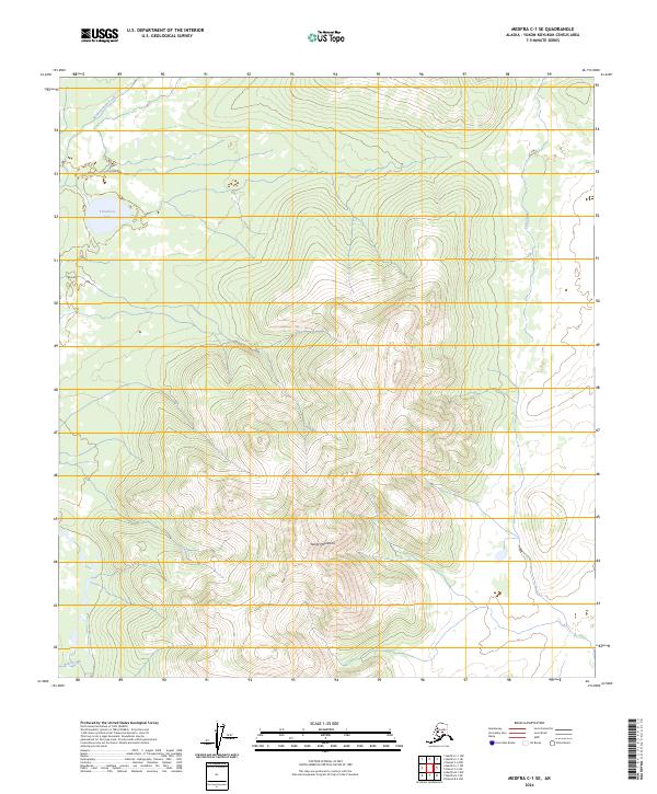
2024 Map of Medfra C-1 SE
USGS Topo · Published 2024About this map
The Telida Mountains dominate the southern half of this interior Alaskan landscape, characterized by steep elevation changes and intricate drainage patterns. In the northwest, Teliamina Lake sits in a lower basin, serving as a prominent landmark in an otherwise unpopulated wilderness. The hydrology of the area is defined by the winding course of Medicineman Creek and Fish Creek, which navigate the northern slopes and valleys. To the far south, the appearance of Red Slough suggests the transition into a broader alluvial plain. This survey provides a precise record of the natural landforms and township boundaries within the Yukon-Koyukuk Census Area prior to modern development, focusing entirely on the topographic and hydrographic features of the Alaskan interior.
Find a feature on this map
13 named features on this map. Tap any name to fly to it.
Don’t see what you’re looking for? This feature index may not catch every label — zoom into the map to look around manually.
Map Details
Editions of this 2024 Medfra C-1 SE Map
This is the sole edition of this map. No revisions or reprints were ever made.
Other maps of this area

1950 · Medfra
USGS Topo · 1:250,000

1952 · Mount McKinley
USGS Topo · 1:250,000

1958 · Medfra C-1
USGS Topo · 1:63,360

1958 · Mount McKinley B-6
USGS Topo · 1:63,360

1958 · Mount McKinley C-6
USGS Topo · 1:63,360

1958 · Mount McKinley
USGS Topo · 1:250,000

1958 · Medfra B-1
USGS Topo · 1:63,360

1959 · Medfra
USGS Topo · 1:250,000

1969 · Mount McKinley
USGS Topo · 1:250,000
2017 · Denali C-6 NW
USGS Topo · 1:25,000