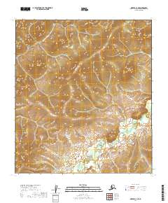
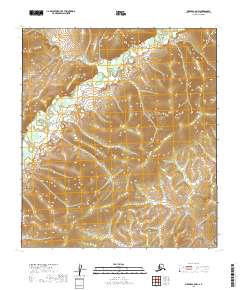
2019 Map of Medfra C-6 NE
USGS Topo · Published 2019About this map
The N Fork Innoko River winds through the northern reaches of this interior Alaskan landscape, marking a terrain defined by complex hydrography and elevation. Situated within the Yukon-Koyukuk Census Area, the map illustrates the winding path of the Susulatna River as it traverses the southern sections of the quadrangle. The lack of roads or established settlements on this 2019 survey highlights the isolated nature of this wilderness area. Surveyed for the National Geospatial Program, the map provides detailed contour intervals that reveal the relief of the surrounding hills, emphasizing the drainage patterns that feed into these two primary river systems. This data is essential for understanding the natural geography and water flow within these remote townships.
Find a feature on this map
6 named features on this map. Tap any name to fly to it.
Don’t see what you’re looking for? This feature index may not catch every label — zoom into the map to look around manually.
Map Details
Editions of this 2019 Medfra C-6 NE Map
This is the sole edition of this map. No revisions or reprints were ever made.
Other maps of this area

1950 · Medfra
USGS Topo · 1:250,000

1954 · Medfra C-6
USGS Topo · 1:63,360

1954 · Medfra C-5
USGS Topo · 1:63,360

1954 · Medfra D-5
USGS Topo · 1:63,360

1954 · Medfra D-6
USGS Topo · 1:63,360

1959 · Medfra
USGS Topo · 1:250,000
2019 · Medfra C-6 SW
USGS Topo · 1:25,000
2019 · Medfra D-5 SW
USGS Topo · 1:25,000
2019 · Medfra C-6 SE
USGS Topo · 1:25,000
2019 · Medfra C-5 NW
USGS Topo · 1:25,000