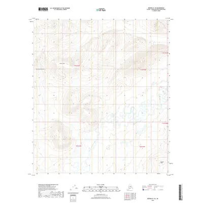
2019 Map of Medfra D-1 SE
USGS Topo · Published 2019About this map
The North Fork Kuskokwim River meanders across the lower half of this landscape, its complex oxbows and abandoned channels creating a distinctive wetland pattern within the Unorganized Borough. This 2019 data illustrates the topographic transition from the high elevations of the Kuskokwim Mountains to the low-lying river valley. Significant landmarks include Dyckman Mtn in the north and the southern extent of Munsatli Ridge, providing clear reference points for navigation through this wilderness. The map is defined by the Public Land Survey System grid, specifically identifying townships such as t19s r29e and t20s r30e, which are essential for property and resource tracking in this undeveloped region.
Find a feature on this map
10 named features on this map. Tap any name to fly to it.
Don’t see what you’re looking for? This feature index may not catch every label — zoom into the map to look around manually.
Map Details
Editions of this 2019 Medfra D-1 SE Map
This is the sole edition of this map. No revisions or reprints were ever made.
Other maps of this area

1950 · Medfra
USGS Topo · 1:250,000

1952 · Mount McKinley
USGS Topo · 1:250,000

1958 · Medfra C-1
USGS Topo · 1:63,360

1958 · Medfra D-1
USGS Topo · 1:63,360

1958 · Mount McKinley D-6
USGS Topo · 1:63,360

1958 · Mount McKinley C-6
USGS Topo · 1:63,360

1958 · Mount McKinley
USGS Topo · 1:250,000

1959 · Medfra
USGS Topo · 1:250,000

1969 · Mount McKinley
USGS Topo · 1:250,000
2017 · Denali D-6 SW
USGS Topo · 1:25,000