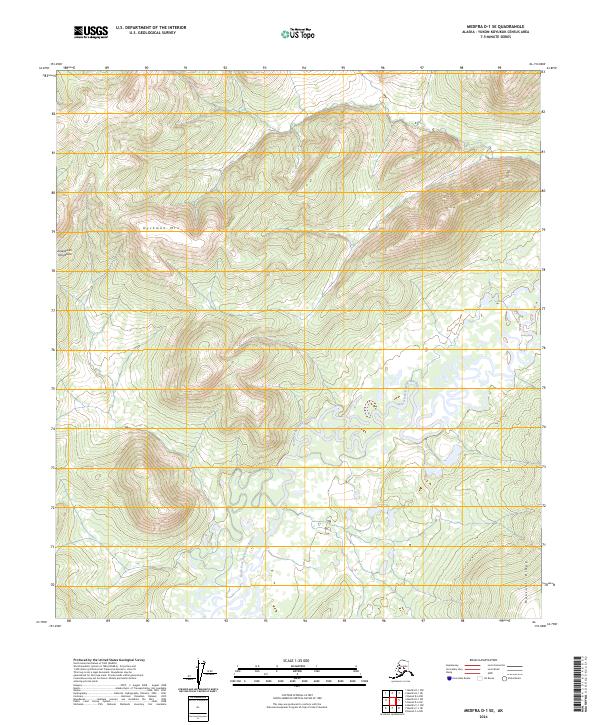
2024 Map of Medfra D-1 SE
USGS Topo · Published 2024About this map
The North Fork Kuskokwim River meanders through a landscape defined by the elevations of the Kuskokwim Mountains in this interior Alaskan wilderness. The terrain is dominated by prominent landforms such as Dyckman Mtn in the northern sector and the reaching heights of Munsatli Ridge to the southeast. This map illustrates the intricate drainage patterns of the river valley, where dozens of oxbow lakes and wetlands flank the main channel, indicative of a dynamic riparian environment. The lack of roads or established settlements emphasizes the remote nature of the Yukon-Koyukuk Census Area, where the topography and the river's path provide the primary landmarks for navigation and land management across several township and range boundaries.
Find a feature on this map
10 named features on this map. Tap any name to fly to it.
Don’t see what you’re looking for? This feature index may not catch every label — zoom into the map to look around manually.
Map Details
Editions of this 2024 Medfra D-1 SE Map
This is the sole edition of this map. No revisions or reprints were ever made.
Other maps of this area

1950 · Medfra
USGS Topo · 1:250,000

1952 · Mount McKinley
USGS Topo · 1:250,000

1958 · Medfra C-1
USGS Topo · 1:63,360

1958 · Medfra D-1
USGS Topo · 1:63,360

1958 · Mount McKinley D-6
USGS Topo · 1:63,360

1958 · Mount McKinley C-6
USGS Topo · 1:63,360

1958 · Mount McKinley
USGS Topo · 1:250,000

1959 · Medfra
USGS Topo · 1:250,000

1969 · Mount McKinley
USGS Topo · 1:250,000
2017 · Denali D-6 SW
USGS Topo · 1:25,000