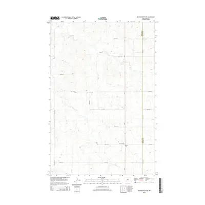
2014 Map of Medicine Butte SE
USGS Topo · Published 2014About this map
Peace Cem and Unruh Cem are prominent markers of the heritage found along the border of Mercer and Oliver counties. This rural landscape is defined by the drainage of Coyote Cr, which meanders through a network of section lines and gravel roads. The transport framework is anchored by ND-49, while a series of county routes like CR-16 and CR-25 connect the isolated homesteads and burial grounds of the region. The presence of New Gluecksthal Cem and Voegele Cem reflects the distinct settler history and family lineage tied to this specific corner of the North Dakota plains. The map's grid layout, including names like 24th St SW and 60th Ave SW, illustrates the enduring structure of the township and range system into the early twenty-first century.
Find a feature on this map
24 named features on this map. Tap any name to fly to it.
Don’t see what you’re looking for? This feature index may not catch every label — zoom into the map to look around manually.
Map Details
Editions of this 2014 Medicine Butte SE Map
This is the sole edition of this map. No revisions or reprints were ever made.
Other maps of this area

1954 · Bismarck
USGS Topo · 1:250,000

1954 · McClusky
USGS Topo · 1:250,000

1958 · Bismarck
USGS Topo · 1:250,000

1958 · McClusky
USGS Topo · 1:250,000

1968 · Medicine Butte NE
USGS Topo · 1:24,000

1968 · Red Butte NW
USGS Topo · 1:24,000

1968 · Medicine Butte
USGS Topo · 1:24,000

1970 · Hailstone Butte
USGS Topo · 1:24,000

1970 · Glen Ullin NE
USGS Topo · 1:24,000
1970 · Glen Ullin NW
USGS Topo · 1:24,000