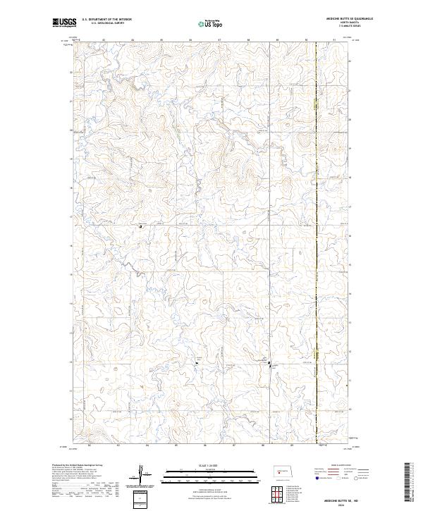
2024 Map of Medicine Butte SE
USGS Topo · Published 2024About this map
The agrarian landscape along the boundary of Mercer Co and Oliver Co is defined by a grid of rural section roads and small family cemeteries that testify to the region's settlement history. These small burial grounds, including Peace Cem, Unruh Cem, New Gluecksthal Cem, and Voegele Cem, are scattered across the plains, often situated near township and range lines like t141n r88w. The network of local thoroughfares, such as Co Rd 16 and 27th St SW, connects these isolated landmarks across a terrain marked by subtle drainage patterns and traditional land divisions. This map provides a detailed view of the infrastructure and genealogical markers within this corner of North Dakota as it appears in the early 2020s.
Find a feature on this map
20 named features on this map. Tap any name to fly to it.
Don’t see what you’re looking for? This feature index may not catch every label — zoom into the map to look around manually.
Map Details
Editions of this 2024 Medicine Butte SE Map
This is the sole edition of this map. No revisions or reprints were ever made.
Other maps of this area

1954 · Bismarck
USGS Topo · 1:250,000

1954 · McClusky
USGS Topo · 1:250,000

1958 · Bismarck
USGS Topo · 1:250,000

1958 · McClusky
USGS Topo · 1:250,000

1968 · Medicine Butte NE
USGS Topo · 1:24,000

1968 · Red Butte NW
USGS Topo · 1:24,000

1968 · Medicine Butte
USGS Topo · 1:24,000

1970 · Hailstone Butte
USGS Topo · 1:24,000

1970 · Glen Ullin NE
USGS Topo · 1:24,000
1970 · Glen Ullin NW
USGS Topo · 1:24,000