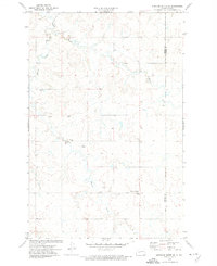
1972 Map of Medicine Butte SE
USGS Topo · Published 1974About this map
The rolling prairies of the Mercer Co and Oliver Co border region are defined by a network of drainage systems and small-scale resource extraction. Following the winding course of Beaver Creek and Coyote Creek, the landscape is dotted with evidence of local activity including several mines and distinctive scoria pits. Of particular value to genealogists are the rural burial sites preserved on this sheet, including the Unruh Cem, New Gluecksthal Cem, Voegele Cem, and Peace Cem. These landmarks, along with many gravel pits, reveal a landscape shaped by both the natural watercourses and the practical needs of the local farming and ranching community in the early 1970s.
Find a feature on this map
11 named features on this map. Tap any name to fly to it.
Don’t see what you’re looking for? This feature index may not catch every label — zoom into the map to look around manually.
Map Details
Editions of this 1972 Medicine Butte SE Map
This is the sole edition of this map. No revisions or reprints were ever made.
Other maps of this area

1954 · Bismarck
USGS Topo · 1:250,000

1954 · McClusky
USGS Topo · 1:250,000

1958 · Bismarck
USGS Topo · 1:250,000

1958 · McClusky
USGS Topo · 1:250,000

1968 · Medicine Butte NE
USGS Topo · 1:24,000

1968 · Red Butte NW
USGS Topo · 1:24,000

1968 · Medicine Butte
USGS Topo · 1:24,000

1970 · Hailstone Butte
USGS Topo · 1:24,000

1970 · Glen Ullin NE
USGS Topo · 1:24,000
1970 · Glen Ullin NW
USGS Topo · 1:24,000