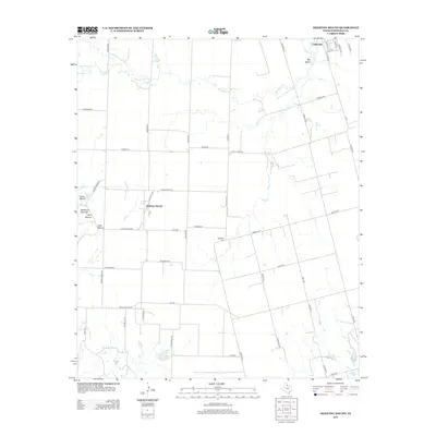
2012 Map of Medicine Mound
USGS Topo · Published 2012About this map
Medicine Mound stands as a prominent topographical and cultural landmark in this section of Hardeman County, surrounded by distinctive peaks including Cedar Mound, Third Mound, and Little Mound. These elevations rise above the surrounding plains where Wanderers Cr meanders toward the northeast. The settlement patterns here are defined by the intersection of rural ranch roads and the Bnsf rail line, which services the town of Chillicothe in the upper corner of the map.
Find a feature on this map
53 named features on this map. Tap any name to fly to it.
Don’t see what you’re looking for? This feature index may not catch every label — zoom into the map to look around manually.
Map Details
Editions of this 2012 Medicine Mound Map
This is the sole edition of this map. No revisions or reprints were ever made.
Other maps of this area

1955 · Lawton
USGS Topo · 1:250,000

1958 · Vernon
USGS Topo · 1:62,500

1958 · Medicine Mound
USGS Topo · 1:62,500

1958 · Elmer
USGS Topo · 1:62,500

1960 · Quanah
USGS Topo · 1:62,500

1983 · Warrior Hollow
USGS Topo · 1:24,000

1983 · Tolbert
USGS Topo · 1:24,000
1983 · Rayland
USGS Topo · 1:24,000

1983 · Big Mound
USGS Topo · 1:24,000
1983 · Margaret
USGS Topo · 1:24,000