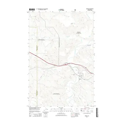
2014 Map of Medora
USGS Topo · Published 2014About this map
Medora sits at a critical junction of the Little Missouri River and the western rail lines, serving as a gateway to the high plateaus of western North Dakota. The landscape is defined by the proximity of Theodore Roosevelt National Park and the expansive Little Missouri National Grassland, where the rugged topography is punctuated by numerous springs and seeps. Local landmarks such as Medora Cem and the Medora Oil Field illustrate the intersection of pioneer heritage and modern industry. The transport network follows the natural drainage of the land, with W River Rd and Pacific Ave tracing the river valley. Water remains the lifeblood of the region, marked by named features like Lone Tree Spring, Wannagan Seeps, and Sheep Pasture Spring that once supported the ranching and settlement of the Peaceful Valley area.
Find a feature on this map
26 named features on this map. Tap any name to fly to it.
Don’t see what you’re looking for? This feature index may not catch every label — zoom into the map to look around manually.
Map Details
Editions of this 2014 Medora Map
This is the sole edition of this map. No revisions or reprints were ever made.
Other maps of this area

1953 · Dickinson
USGS Topo · 1:250,000

1953 · Watford City
USGS Topo · 1:250,000

1957 · Dickinson
USGS Topo · 1:250,000

1957 · Watford City
USGS Topo · 1:250,000

1962 · Tracy Mountain
USGS Topo · 1:24,000

1962 · Fryburg NW
USGS Topo · 1:24,000

1963 · Gorham SW
USGS Topo · 1:24,000

1967 · Watford City
USGS Topo · 1:250,000

1970 · Wannagan Creek East
USGS Topo · 1:24,000

1970 · Medora
USGS Topo · 1:24,000