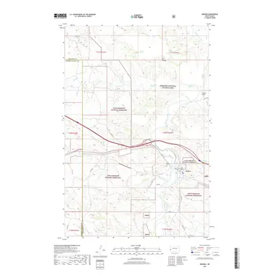
2017 Map of Medora
USGS Topo · Published 2017About this map
The Little Missouri River carves a winding path through this western North Dakota landscape, anchoring a region defined by protected lands and the historic town of Medora. This area serves as a gateway to Theodore Roosevelt National Park and the surrounding Little Missouri National Grassland, where the rugged terrain transitions from the high elevations of Big Plateau to the sheltered area of Peaceful Valley. Transport and travel patterns are clearly visible, from the route of Old Hwy 10 and Pacific Ave to the local tracks and cemeteries like Medora Cem. The hydrological network is dense with named water sources essential to this arid environment, including Wannagan Seeps, Tomamichael Spring, and numerous creeks such as Knutson Cr and Sully Cr that drain into the main river valley.
Find a feature on this map
35 named features on this map. Tap any name to fly to it.
Don’t see what you’re looking for? This feature index may not catch every label — zoom into the map to look around manually.
Map Details
Editions of this 2017 Medora Map
This is the sole edition of this map. No revisions or reprints were ever made.
Other maps of this area

1953 · Dickinson
USGS Topo · 1:250,000

1953 · Watford City
USGS Topo · 1:250,000

1957 · Dickinson
USGS Topo · 1:250,000

1957 · Watford City
USGS Topo · 1:250,000

1962 · Tracy Mountain
USGS Topo · 1:24,000

1962 · Fryburg NW
USGS Topo · 1:24,000

1963 · Gorham SW
USGS Topo · 1:24,000

1967 · Watford City
USGS Topo · 1:250,000

1970 · Wannagan Creek East
USGS Topo · 1:24,000

1970 · Medora
USGS Topo · 1:24,000