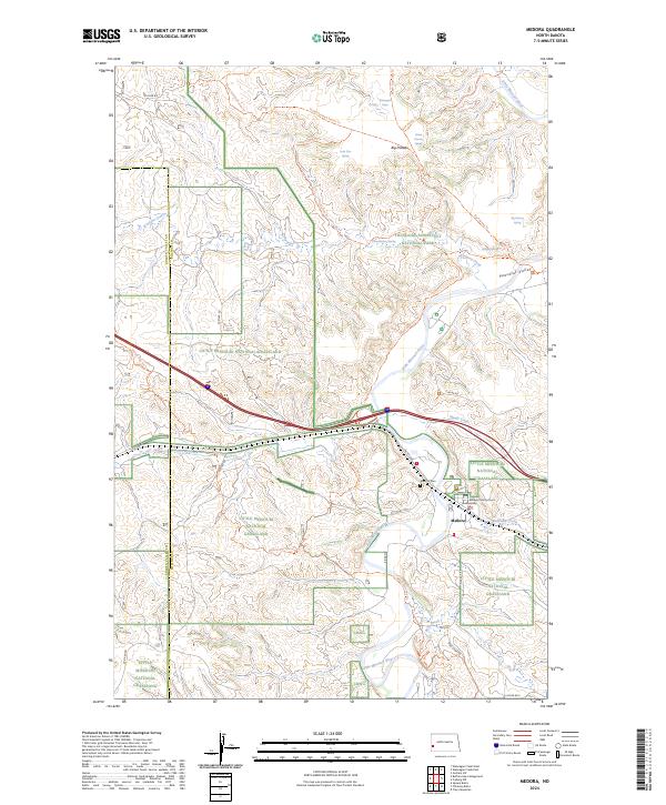
2024 Map of Medora
USGS Topo · Published 2024About this map
Medora serves as the focal point of this western North Dakota landscape, situated at a bend in the Little Missouri River. The settlement is closely integrated with protected lands, including Theodore Roosevelt National Park and the surrounding Little Missouri National Grassland. Cultural and administrative landmarks like the Billings County Court House and Medora Cem stand near the confluence of Railroad Creek and the river, reflecting the area's role as a county seat and historical hub.
Find a feature on this map
42 named features on this map. Tap any name to fly to it.
Don’t see what you’re looking for? This feature index may not catch every label — zoom into the map to look around manually.
Map Details
Editions of this 2024 Medora Map
This is the sole edition of this map. No revisions or reprints were ever made.
Other maps of this area

1953 · Dickinson
USGS Topo · 1:250,000

1953 · Watford City
USGS Topo · 1:250,000

1957 · Dickinson
USGS Topo · 1:250,000

1957 · Watford City
USGS Topo · 1:250,000

1962 · Tracy Mountain
USGS Topo · 1:24,000

1962 · Fryburg NW
USGS Topo · 1:24,000

1963 · Gorham SW
USGS Topo · 1:24,000

1967 · Watford City
USGS Topo · 1:250,000

1970 · Wannagan Creek East
USGS Topo · 1:24,000

1970 · Medora
USGS Topo · 1:24,000