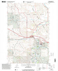
1997 Map of Medora
USGS Topo · Published 2001About this map
Medora sits at a critical juncture of history and topography, where the Burlington Northern Railroad crosses the Little Missouri River. This landscape is heavily shaped by both public conservation and legacy ranching, with the Theodore Roosevelt National Park (South Unit) and the Little Missouri National Grassland dominating the terrain. The presence of the Chateau de Mores State Historic Site highlights the area's late 19th-century frontier heritage, while modern infrastructure like the Sewage Disposal Ponds and Waterworks reflect the town's ongoing evolution as a regional hub.
Find a feature on this map
34 named features on this map. Tap any name to fly to it.
Don’t see what you’re looking for? This feature index may not catch every label — zoom into the map to look around manually.
Map Details
Editions of this 1997 Medora Map
This is the sole edition of this map. No revisions or reprints were ever made.
Other maps of this area

1953 · Dickinson
USGS Topo · 1:250,000

1953 · Watford City
USGS Topo · 1:250,000

1957 · Dickinson
USGS Topo · 1:250,000

1957 · Watford City
USGS Topo · 1:250,000

1962 · Tracy Mountain
USGS Topo · 1:24,000

1962 · Fryburg NW
USGS Topo · 1:24,000

1963 · Gorham SW
USGS Topo · 1:24,000

1967 · Watford City
USGS Topo · 1:250,000

1970 · Wannagan Creek East
USGS Topo · 1:24,000

1970 · Medora
USGS Topo · 1:24,000