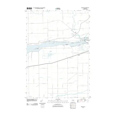
2010 Map of Meehan
USGS Topo · Published 2010About this map
The Wisconsin River carves a broad path through this landscape south of Biron, defining the local geography with features like Pleasure Island and the sprawling banks near Rocky Run. The settlement of Meehan serves as a focal point along the state road, while the surrounding Wood County countryside is crisscrossed by a grid of rural lanes and family-named routes such as Huffman Rd and Gumz Rd.
Find a feature on this map
59 named features on this map. Tap any name to fly to it.
Don’t see what you’re looking for? This feature index may not catch every label — zoom into the map to look around manually.
Map Details
Editions of this 2010 Meehan Map
This is the sole edition of this map. No revisions or reprints were ever made.
Other maps of this area

1955 · Green Bay
USGS Topo · 1:250,000

1956 · Milladore
USGS Topo · 1:48,000

1956 · Stevens Point
USGS Topo · 1:48,000

1957 · Wisconsin Rapids
USGS Topo · 1:48,000

1957 · Whiting
USGS Topo · 1:48,000

1967 · Wisconsin Rapids
USGS Topo · 1:62,500

1970 · Kellner
USGS Topo · 1:24,000

1970 · Junction City
USGS Topo · 1:24,000

1970 · Stevens Point
USGS Topo · 1:24,000
1970 · Bancroft
USGS Topo · 1:24,000