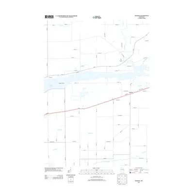
2013 Map of Meehan
USGS Topo · Published 2013About this map
Meehan serves as a central point of reference in this Wood County landscape, situated just north of the extensive Biron Flowage. The geography is defined by a dense network of watercourses, including Mill Creek, Rocky Run, and Bear Cr in the northern reaches, while Twomile Cr and Quinnell Cr drain the central region. The southern edge is marked by the winding path of Buena Vista Cr. This area reflects a structured rural layout where major roads like Wi-66 and Plover Rd intersect with local lanes named after the natural environment, such as Red Pine Ln and Bluejay Rd. The presence of Pleasure Island within the flowage indicates the significance of the river system for local navigation and geography. The map provides a detailed view of the transition between open water and the grid of residential and agricultural plots that define this Wisconsin community.
Find a feature on this map
69 named features on this map. Tap any name to fly to it.
Don’t see what you’re looking for? This feature index may not catch every label — zoom into the map to look around manually.
Map Details
Editions of this 2013 Meehan Map
This is the sole edition of this map. No revisions or reprints were ever made.
Other maps of this area

1955 · Green Bay
USGS Topo · 1:250,000

1956 · Milladore
USGS Topo · 1:48,000

1956 · Stevens Point
USGS Topo · 1:48,000

1957 · Wisconsin Rapids
USGS Topo · 1:48,000

1957 · Whiting
USGS Topo · 1:48,000

1967 · Wisconsin Rapids
USGS Topo · 1:62,500

1970 · Kellner
USGS Topo · 1:24,000

1970 · Junction City
USGS Topo · 1:24,000

1970 · Stevens Point
USGS Topo · 1:24,000
1970 · Bancroft
USGS Topo · 1:24,000