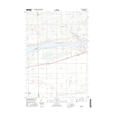
2015 Map of Meehan
USGS Topo · Published 2015About this map
The Biron Flowage of the Wisconsin River anchors this landscape at the boundary of Wood Co and Portage Co. Near the northern bank, the Linwood Union Cem serves as a significant genealogical landmark, while the village of Biron and the settlement at Meehan define the local residential footprint. The terrain is notably aquatic, dominated by drainage networks like Mill Creek, Twomile Cr, and Buena Vista Cr that feed into the central waterway or nearby Lake Wazeecha.
Find a feature on this map
59 named features on this map. Tap any name to fly to it.
Don’t see what you’re looking for? This feature index may not catch every label — zoom into the map to look around manually.
Map Details
Editions of this 2015 Meehan Map
This is the sole edition of this map. No revisions or reprints were ever made.
Other maps of this area

1955 · Green Bay
USGS Topo · 1:250,000

1956 · Milladore
USGS Topo · 1:48,000

1956 · Stevens Point
USGS Topo · 1:48,000

1957 · Wisconsin Rapids
USGS Topo · 1:48,000

1957 · Whiting
USGS Topo · 1:48,000

1967 · Wisconsin Rapids
USGS Topo · 1:62,500

1970 · Kellner
USGS Topo · 1:24,000

1970 · Junction City
USGS Topo · 1:24,000

1970 · Stevens Point
USGS Topo · 1:24,000
1970 · Bancroft
USGS Topo · 1:24,000