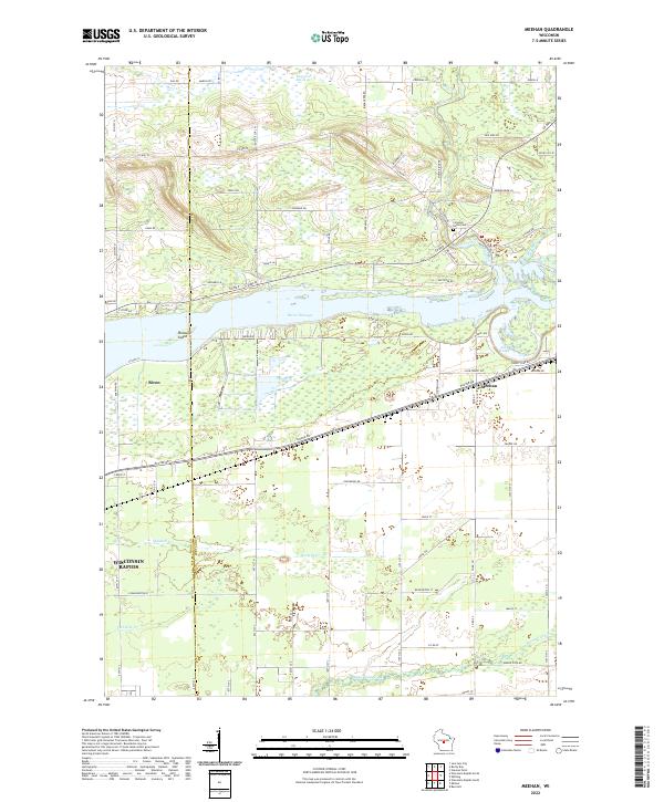
2022 Map of Meehan
USGS Topo · Published 2022About this map
The Wood Co Portage Co border runs north-to-south through this landscape, dividing the riverfront community of Biron from the eastern marshlands. Centered on the Biron Flowage, the terrain transition from the developed outskirts of Wisconsin Rapids to the sprawling Bear Creek Marsh is clearly defined. The Wisconsin River dominates the central portion of the map, featuring Pleasure Island and a network of tributary systems including Mill Creek and Rock Run.
Find a feature on this map
91 named features on this map. Tap any name to fly to it.
Don’t see what you’re looking for? This feature index may not catch every label — zoom into the map to look around manually.
Map Details
Editions of this 2022 Meehan Map
This is the sole edition of this map. No revisions or reprints were ever made.
Other maps of this area

1955 · Green Bay
USGS Topo · 1:250,000

1956 · Milladore
USGS Topo · 1:48,000

1956 · Stevens Point
USGS Topo · 1:48,000

1957 · Wisconsin Rapids
USGS Topo · 1:48,000

1957 · Whiting
USGS Topo · 1:48,000

1967 · Wisconsin Rapids
USGS Topo · 1:62,500

1970 · Kellner
USGS Topo · 1:24,000

1970 · Junction City
USGS Topo · 1:24,000

1970 · Stevens Point
USGS Topo · 1:24,000
1970 · Bancroft
USGS Topo · 1:24,000