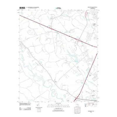
2012 Map of Meldrim SE
USGS Topo · Published 2012About this map
The Little Ogeechee River and Ogeechee River dominate this coastal Georgia landscape just west of Savannah. Small settlements like Tutens, Williams, and Henderson are connected by a network of rural roads such as Pine Barren Rd and Old Little Neck Rd. The area is notably marked by numerous family and community burial grounds, including the Hopeton Plantation Cemetery, Bethel Cemetery, and Sand Hill Cemetery. Human modification of the wet lowlands is evident in the straight lines of the Hardin Canal and the presence of the Little Ogeechee Pond. Significant landmarks such as the Pooler Post Office and the Hopeton Plantation Field reflect the transition between agricultural heritage and modern suburban development represented by the Savannah Festival Shops.
Find a feature on this map
46 named features on this map. Tap any name to fly to it.
Don’t see what you’re looking for? This feature index may not catch every label — zoom into the map to look around manually.
Map Details
Editions of this 2012 Meldrim SE Map
This is the sole edition of this map. No revisions or reprints were ever made.
Other maps of this area

1920 · Meldrim
USGS Topo · 1:62,500

1920 · Limerick
USGS Topo · 1:62,500

1942 · Meldrim
USGS Topo · 1:62,500

1942 · Savannah
USGS Topo · 1:62,500

1944 · Limerick
USGS Topo · 1:62,500

1944 · Ossabaw Island
USGS Topo · 1:62,500

1945 · Ossabaw Island
USGS Topo · 1:62,500

1946 · Brunswick
USGS Topo · 1:250,000

1947 · Savannah
USGS Topo · 1:250,000

1948 · Brunswick
USGS Topo · 1:250,000