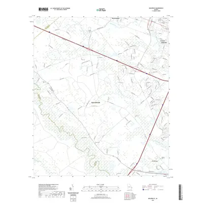
2020 Map of Meldrim SE
USGS Topo · Published 2020About this map
The Ogeechee River and Little Ogeechee River define the watery southern reaches of this region, where the wetlands of Horse Pen Swamp and Culvert Swamp meet emerging suburban expansion. This landscape is a patchwork of historical land use, showing the engineered water systems of the Hardin Canal and the legacy of the Savannah and Ogeechee Canal. Local history is anchored by numerous burial grounds, including the Hopeton Plantation Cem and Brickyard Cem, which sit alongside the modern boundaries of Savannah, Pooler, and Bloomingdale. The map captures the meeting point of Effingham, Bryan, and Chatham counties, illustrating a complex network of transportation routes like Fort Argyle Rd and Louisville Rd that bridge the gaps between historic plantation sites and current-day residential growth.
Find a feature on this map
121 named features on this map. Tap any name to fly to it.
Don’t see what you’re looking for? This feature index may not catch every label — zoom into the map to look around manually.
Map Details
Editions of this 2020 Meldrim SE Map
This is the sole edition of this map. No revisions or reprints were ever made.
Other maps of this area

1920 · Meldrim
USGS Topo · 1:62,500

1920 · Limerick
USGS Topo · 1:62,500

1942 · Meldrim
USGS Topo · 1:62,500

1942 · Savannah
USGS Topo · 1:62,500

1944 · Limerick
USGS Topo · 1:62,500

1944 · Ossabaw Island
USGS Topo · 1:62,500

1945 · Ossabaw Island
USGS Topo · 1:62,500

1946 · Brunswick
USGS Topo · 1:250,000

1947 · Savannah
USGS Topo · 1:250,000

1948 · Brunswick
USGS Topo · 1:250,000