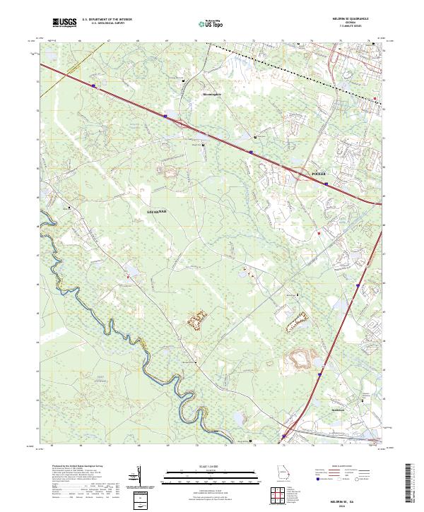
2024 Map of Meldrim SE
USGS Topo · Published 2024About this map
The Ogeechee River and its meandering tributaries dominate the low-lying terrain west of Savannah, defining the borders where Chatham Co meets Effingham and Bryan counties. This coastal Georgia landscape is shaped by significant water management features, most notably the Savannah and Ogeechee Canal and the Hardin Canal, which cut through the wetlands near Pooler and Bloomingdale. The map reveals a dense distribution of family and community burial sites, from Newton Cem in the north to the Hopeton Plantation Cem further south near Henderson. Large swaths of the southwestern quadrant are occupied by the military reservation of Fort Stewart, while the surrounding areas show the encroaching suburban growth around the intersection of Interstate 16 and Pooler Pkwy. Natural features like Horse Pen Swamp and Culvert Swamp persist amidst this development, illustrating the local challenge of building within the Georgia coastal plain's drainage networks.
Find a feature on this map
120 named features on this map. Tap any name to fly to it.
Don’t see what you’re looking for? This feature index may not catch every label — zoom into the map to look around manually.
Map Details
Editions of this 2024 Meldrim SE Map
This is the sole edition of this map. No revisions or reprints were ever made.
Other maps of this area

1920 · Meldrim
USGS Topo · 1:62,500

1920 · Limerick
USGS Topo · 1:62,500

1942 · Meldrim
USGS Topo · 1:62,500

1942 · Savannah
USGS Topo · 1:62,500

1944 · Limerick
USGS Topo · 1:62,500

1944 · Ossabaw Island
USGS Topo · 1:62,500

1945 · Ossabaw Island
USGS Topo · 1:62,500

1946 · Brunswick
USGS Topo · 1:250,000

1947 · Savannah
USGS Topo · 1:250,000

1948 · Brunswick
USGS Topo · 1:250,000