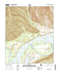
2016 Map of Melozitna A-1 NE
USGS Topo · Published 2016About this map
Kallands marks a singular human footprint on this stretch of the Yukon River, where the landscape transitions from the high elevations of Blueberry Ridge to a complex system of river braids and islands. The northern terrain is defined by steep contour intervals and drainages like Ida Gulch, which feed into the massive river corridor below. This 2016 survey illustrates the dynamic nature of the river, where shifting channels have created large landforms such as Tremel Island, Brant Island, and Lange Island. To the west, the river is constricted by Brant Bluff and Painter Point, showing how the local topography dictates the water's path through this interior region of Alaska. The map provides a clear record of the relationship between the elevated ridges and the active fluvial environment.
Find a feature on this map
12 named features on this map. Tap any name to fly to it.
Don’t see what you’re looking for? This feature index may not catch every label — zoom into the map to look around manually.
Map Details
Editions of this 2016 Melozitna A-1 NE Map
This is the sole edition of this map. No revisions or reprints were ever made.
Other maps of this area

1951 · Melozitna
USGS Topo · 1:250,000

1951 · Tanana
USGS Topo · 1:250,000

1952 · Tanana A-6
USGS Topo · 1:63,360

1952 · Melozitna A-1
USGS Topo · 1:63,360

1956 · Melozitna B-1
USGS Topo · 1:63,360

1956 · Tanana B-6
USGS Topo · 1:63,360

1956 · Melozitna
USGS Topo · 1:250,000

1956 · Tanana
USGS Topo · 1:250,000

1960 · Tanana
USGS Topo · 1:250,000
2016 · Tanana B-6 SW
USGS Topo · 1:25,000