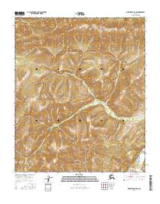
2016 Map of Melozitna A-5 SW
USGS Topo · Published 2016About this map
Detailed land divisions in the Yukon-Koyukuk region are documented in this 2016 survey, organized by the Public Land Survey System. The map defines the boundaries for T4s R16e, T4s R17e, and T4s R18e, along with their southern counterparts including T5s R17e and T5s R18e. This specific portion of interior Alaska is characterized by significant elevation changes, though it remains notably devoid of named settlements or infrastructure. The terrain is defined primarily by its topographic relief and the intersection of various survey lines such as T6s R17e and T6s R18e, providing a technical look at how this remote landscape was systematically measured and categorized for administrative purposes in the early 21st century.
Find a feature on this map
7 named features on this map. Tap any name to fly to it.
Don’t see what you’re looking for? This feature index may not catch every label — zoom into the map to look around manually.
Map Details
Editions of this 2016 Melozitna A-5 SW Map
This is the sole edition of this map. No revisions or reprints were ever made.
Other maps of this area

1951 · Ruby
USGS Topo · 1:250,000

1951 · Melozitna
USGS Topo · 1:250,000

1952 · Ruby D-6
USGS Topo · 1:63,360

1952 · Ruby D-5
USGS Topo · 1:63,360
1952 · Melozitna A-6
USGS Topo · 1:63,360

1952 · Ruby
USGS Topo · 1:250,000
1954 · Melozitna A-5
USGS Topo · 1:63,360

1956 · Melozitna
USGS Topo · 1:250,000

1964 · Ruby
USGS Topo · 1:250,000
2016 · Melozitna A-6 SE
USGS Topo · 1:25,000