
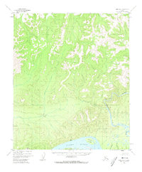
1952 Map of Ruby D-6
USGS Topo · Published 1957About this map
The Yukon River flows along the southern edge of this mid-century Alaskan interior landscape, a vital corridor for travel and trade in the Yukon-Koyukuk region. In the early 1950s, this area remained largely wild, with the Melozi (Site) on the northern bank of the Yukon marking a point of human activity near the mouth of the Melozitna River. This tributary snakes through the center of the map, carving through the Melozitna Canyon as it descends from the northern uplands.
Find a feature on this map
12 named features on this map. Tap any name to fly to it.
Don’t see what you’re looking for? This feature index may not catch every label — zoom into the map to look around manually.
Map Details
Editions of this 1952 Ruby D-6 Map
2 editions found
Other maps of this area

1945 · Nulato
USGS Topo · 1:250,000

1951 · Nulato
USGS Topo · 1:250,000

1951 · Ruby
USGS Topo · 1:250,000

1951 · Kateel River
USGS Topo · 1:250,000

1951 · Melozitna
USGS Topo · 1:250,000

1952 · Nulato C-1
USGS Topo · 1:63,360

1952 · Nulato D-1
USGS Topo · 1:63,360

1952 · Kateel River A-1
USGS Topo · 1:63,360

1952 · Ruby D-5
USGS Topo · 1:63,360

1952 · Ruby C-5
USGS Topo · 1:63,360