
1952 Map of Ruby C-5
USGS Topo · Published 1957About this map
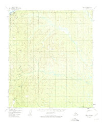
Ruby sits along the southern bank of the Yukon River at the northwestern edge of this 1950s interior Alaska landscape. The settlement is anchored by navigation and communication infrastructure, including a Landing Area, Radio Towers, and the Ruby Astro station. From the river, the terrain rises into a series of prominent peaks and ridgelines, most notably Scow Mountain and Boston Dome. The hydrology of the region is defined by a dense network of drainages like Big Glacier Creek and Beaver Creek that cut through the undulating surface. While much of the area is dominated by wilderness, small clusters of Cabins and a Gravel Pit suggest localized activity and transport routes. This survey provides a look at the essential infrastructure and topography of the Ruby region before significant modern development, documenting the relationship between the riverfront hub and its upland interior.
Find a feature on this map
29 named features on this map. Tap any name to fly to it.
Don’t see what you’re looking for? This feature index may not catch every label — zoom into the map to look around manually.
Map Details
Editions of this 1952 Ruby C-5 Map
4 editions found
Other maps of this area

1951 · Ruby
USGS Topo · 1:250,000

1952 · Ruby D-6
USGS Topo · 1:63,360

1952 · Ruby D-4
USGS Topo · 1:63,360

1952 · Ruby D-5
USGS Topo · 1:63,360

1952 · Ruby B-6
USGS Topo · 1:63,360

1952 · Ruby B-4
USGS Topo · 1:63,360

1952 · Ruby B-5
USGS Topo · 1:63,360

1952 · Ruby C-4
USGS Topo · 1:63,360

1952 · Ruby C-6
USGS Topo · 1:63,360

1952 · Ruby
USGS Topo · 1:250,000