
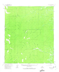
1952 Map of Ruby B-5
USGS Topo · Published 1957About this map
Gold mining operations and remote survey points define this interior Alaskan landscape during the early 1950s. The region is marked by active resource extraction, evidenced by a Placer Mine near Bear Gulch and a Strip Mine along Birch Creek. Small clusters of Cabins and isolated Cabin structures serve as the primary human dwellings, often situated near remote Airstrip clearings that provided the only practical access to these rugged drainages. The complex network of waterways includes Dominion Creek, Quartz Creek, and White Channel Creek, all feeding into the wider wetlands of the Sulatna River basin. High elevation survey markers like VABM Monument 1497 and the distinctive Monument Rocks anchor the terrain, while colorfully named seasonal drainages like Fourth of July Creek and Fifth of July Cr reflect the era's local nomenclature for the surrounding gold-bearing hills.
Find a feature on this map
33 named features on this map. Tap any name to fly to it.
Don’t see what you’re looking for? This feature index may not catch every label — zoom into the map to look around manually.
Map Details
Editions of this 1952 Ruby B-5 Map
2 editions found
Other maps of this area

1951 · Ruby
USGS Topo · 1:250,000

1952 · Ruby A-4
USGS Topo · 1:63,360

1952 · Ruby B-6
USGS Topo · 1:63,360

1952 · Ruby B-4
USGS Topo · 1:63,360

1952 · Ruby C-5
USGS Topo · 1:63,360

1952 · Ruby A-5
USGS Topo · 1:63,360

1952 · Ruby C-4
USGS Topo · 1:63,360

1952 · Ruby A-6
USGS Topo · 1:63,360

1952 · Ruby C-6
USGS Topo · 1:63,360

1952 · Ruby
USGS Topo · 1:250,000