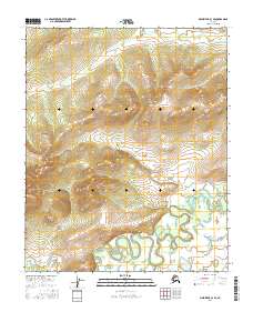
2016 Map of Melozitna C-3 SE
USGS Topo · Published 2016About this map
The interior of the Melozitna region in Alaska is defined by a dense network of braided river channels and severe topographical relief as documented in 2016. Located within the Yukon-Koyukuk Census Area, the landscape transitions from steep mountainous slopes in the north, including territory in T3n R23e and T3n R22e, down into a complex system of wetlands and meandering waterways in the south. This transition from highlands to floodplains is captured across several townships, including T2n R22e and T1n R23e. The area is largely devoid of human infrastructure, focusing instead on the natural hydrology and the Public Land Survey System grid. For the researcher, the map preserves the exact state of these shifting river beds and the precise legal boundaries of the interior before any modern development or further ecological shifts.
Find a feature on this map
6 named features on this map. Tap any name to fly to it.
Don’t see what you’re looking for? This feature index may not catch every label — zoom into the map to look around manually.
Map Details
Editions of this 2016 Melozitna C-3 SE Map
This is the sole edition of this map. No revisions or reprints were ever made.
Other maps of this area

1951 · Melozitna
USGS Topo · 1:250,000

1954 · Melozitna B-3
USGS Topo · 1:63,360

1954 · Melozitna C-3
USGS Topo · 1:63,360

1956 · Melozitna B-2
USGS Topo · 1:63,360
1956 · Melozitna C-2
USGS Topo · 1:63,360

1956 · Melozitna
USGS Topo · 1:250,000
2016 · Melozitna B-3 NE
USGS Topo · 1:25,000
2016 · Melozitna C-2 SW
USGS Topo · 1:25,000
2016 · Melozitna C-2 NW
USGS Topo · 1:25,000
2016 · Melozitna B-2 NW
USGS Topo · 1:25,000