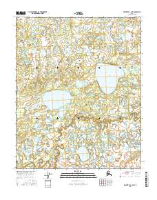
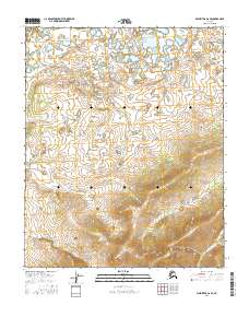
2016 Map of Melozitna C-6 NE
USGS Topo · Published 2016About this map
Hahanudan Lake and its smaller neighbor Hadotohedan Lake dominate the northern terrain of this remote Yukon-Koyukuk landscape. The interior is characterized by a dense network of wetlands and unnamed water bodies that feed into the winding Natnokoka River. This 2016 survey illustrates the pristine hydrology of the region, where Hadokhten Lake sits as a central landmark amidst the complex basin. The presence of Natnokoka Creek (also labeled as Natnokoka Cr) in the southern reaches highlights the seasonal flow patterns and drainage systems that define the geography between the established township boundaries of T4N and T3N. Without roads or permanent settlements, the map focuses entirely on the natural navigational features used by those traversing the Alaskan interior.
Find a feature on this map
10 named features on this map. Tap any name to fly to it.
Don’t see what you’re looking for? This feature index may not catch every label — zoom into the map to look around manually.
Map Details
Editions of this 2016 Melozitna C-6 NE Map
This is the sole edition of this map. No revisions or reprints were ever made.
Other maps of this area

1951 · Melozitna
USGS Topo · 1:250,000

1954 · Melozitna C-5
USGS Topo · 1:63,360

1954 · Melozitna C-6
USGS Topo · 1:63,360

1954 · Melozitna D-5
USGS Topo · 1:63,360

1954 · Melozitna D-6
USGS Topo · 1:63,360

1956 · Melozitna
USGS Topo · 1:250,000
2016 · Melozitna C-5 SW
USGS Topo · 1:25,000
2016 · Melozitna D-6 SE
USGS Topo · 1:25,000
2016 · Melozitna D-6 SW
USGS Topo · 1:25,000
2016 · Melozitna C-6 SE
USGS Topo · 1:25,000