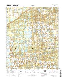
2016 Map of Melozitna C-6 NW
USGS Topo · Published 2016About this map
Nayuka River meanders across the lower portion of this landscape, its tight oxbows and intricate bends indicating a mature, slow-moving waterway. This section of the Yukon-Koyukuk region is characterized by the expansive Dulbi Flats, an area where water and land are nearly indistinguishable. The network of standing water and small lakes is further defined by the Dulbi Slough, which cuts through the western portion of the terrain. The mapping shows an environment shaped by water, with a landscape that suggests seasonal shifts and a dynamic hydrographic network typical of interior Alaska. There are no roads or permanent structures indicated, highlighting the wilderness character of the t4n r14e and t4n r15e townships during this 2016 survey period.
Find a feature on this map
7 named features on this map. Tap any name to fly to it.
Don’t see what you’re looking for? This feature index may not catch every label — zoom into the map to look around manually.
Map Details
Editions of this 2016 Melozitna C-6 NW Map
This is the sole edition of this map. No revisions or reprints were ever made.
Other maps of this area

1951 · Kateel River
USGS Topo · 1:250,000

1951 · Melozitna
USGS Topo · 1:250,000

1954 · Melozitna C-6
USGS Topo · 1:63,360

1954 · Kateel River C-1
USGS Topo · 1:63,360

1954 · Kateel River D-1
USGS Topo · 1:63,360

1954 · Melozitna D-6
USGS Topo · 1:63,360

1955 · Kateel River
USGS Topo · 1:250,000

1956 · Melozitna
USGS Topo · 1:250,000
2016 · Kateel River C-1 SE
USGS Topo · 1:25,000
2016 · Kateel River C-1 NE
USGS Topo · 1:25,000