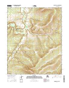
2016 Map of Melozitna D-1 NW
USGS Topo · Published 2016About this map
Indian River meanders through this interior Alaska landscape, defining the drainage patterns of the Melozitna region. This 2016 survey provides a precise look at the topography where Calamity Cr and Big Cr intersect with the higher elevations of the Yukon-Koyukuk interior. The map is primarily characterized by its lack of human infrastructure, focusing instead on the complex contour intervals that illustrate the drainage basins and ridgelines. The division of land is marked by township and range lines, including t7n r26e and t6n r26e, providing a framework for understanding the vast, uninhabited wilderness of the Alaskan bush during the early 21st century.
Find a feature on this map
9 named features on this map. Tap any name to fly to it.
Don’t see what you’re looking for? This feature index may not catch every label — zoom into the map to look around manually.
Map Details
Editions of this 2016 Melozitna D-1 NW Map
This is the sole edition of this map. No revisions or reprints were ever made.
Other maps of this area

1951 · Hughes
USGS Topo · 1:250,000

1951 · Melozitna
USGS Topo · 1:250,000

1952 · Melozitna D-1
USGS Topo · 1:63,360

1955 · Melozitna D-2
USGS Topo · 1:63,360

1955 · Hughes A-2
USGS Topo · 1:63,360

1955 · Hughes A-1
USGS Topo · 1:63,360

1956 · Hughes
USGS Topo · 1:250,000

1956 · Melozitna
USGS Topo · 1:250,000
1956 · Hughes A-2
USGS Topo · 1:63,360

1964 · Hughes
USGS Topo · 1:250,000