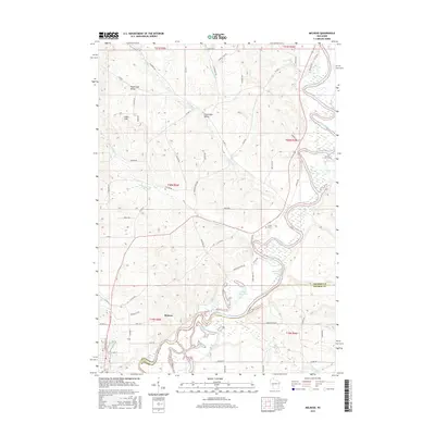
2015 Map of Melrose
USGS Topo · Published 2015About this map
Melrose and the small settlement of Irving occupy the winding corridor of the Black River in this survey of western Wisconsin. The river's path is marked by numerous oxbow lakes and ponds, including Ketchum Lake, Horse Shoe Lake, and Shallow Lake, illustrating the dynamic nature of the waterway. To the north, the landscape rises into distinctive landforms such as Sugar Loaf and the surrounding Sugar Loaf Valley, which contrast with the agricultural flatlands of Cloverdale Valley. The map detail includes several named creeks that feed into the main river system, such as Trout Run, Roaring Cr, and Printz Cr. For those researching local history or genealogy, the Irving Cem is a key landmark located near the riverbank. This documentation of the area at the border of Jackson and Monroe counties provides a detailed look at the rural road network, including the path of Old 54 Rd and Co Hwy H.
Find a feature on this map
77 named features on this map. Tap any name to fly to it.
Don’t see what you’re looking for? This feature index may not catch every label — zoom into the map to look around manually.
Map Details
Editions of this 2015 Melrose Map
This is the sole edition of this map. No revisions or reprints were ever made.
Other maps of this area

1924 · Black River Falls
USGS Topo · 1:62,500

1926 · Black River Falls
USGS Topo · 1:62,500

1926 · North Bend
USGS Topo · 1:62,500

1927 · Blair
USGS Topo · 1:62,500

1928 · Melrose
USGS Topo · 1:48,000

1929 · North Bend
USGS Topo · 1:62,500

1949 · Melrose
USGS Topo · 1:62,500

1953 · Eau Claire
USGS Topo · 1:250,000

1958 · Eau Claire
USGS Topo · 1:250,000

1964 · Eau Claire
USGS Topo · 1:250,000