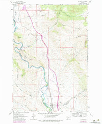
1961 Map of Melrose
USGS Topo · Published 1984About this map
The Big Hole River carves a deep path through this Montana landscape, where the settlement of Melrose stands as a rail-centered hub on the Union Pacific line. This 1961 survey, updated in the late 1970s, reveals a terrain defined by early extraction and sophisticated water management. Numerous mining operations, such as the Old Glory Mine and Maiden Rock Mine, dot the slopes of Old Glory Mountain and the surrounding gulches, while an intricate network of irrigation canals like the McCauley Ditch and Pendergast Ditch divert water to the valley floor.
Find a feature on this map
42 named features on this map. Tap any name to fly to it.
Don’t see what you’re looking for? This feature index may not catch every label — zoom into the map to look around manually.
Map Details
Editions of this 1961 Melrose Map
4 editions found
Other maps of this area

1893 · Dillon
USGS Topo · 1:250,000

1955 · Dillon
USGS Topo · 1:250,000

1957 · Dillon
USGS Topo · 1:250,000

1958 · Dillon
USGS Topo · 1:250,000

1958 · Vipond Park
USGS Topo · 1:62,500

1961 · Melrose
USGS Topo · 1:24,000

1961 · Earls Gulch
USGS Topo · 1:24,000

1961 · Wickiup Creek
USGS Topo · 1:24,000

1961 · Nez Perce Hollow
USGS Topo · 1:24,000

1961 · Butte South
USGS Topo · 1:62,500