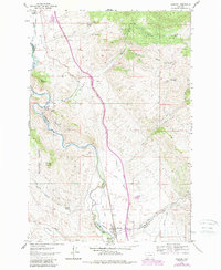
1961 Map of Melrose
USGS Topo · Published 1989About this map
Melrose serves as the focal point for this survey along the winding course of the Big Hole River, where the Union Pacific railroad parallels the water through the valley floor. The map captures a landscape defined by its irrigation and mining history, evidenced by an extensive network of water systems including the Mc Cauley Ditch, Pendergast Ditch, and Stone Creek Ditch. These engineering efforts supported the area's agricultural and mining operations during the mid-20th century.
Find a feature on this map
44 named features on this map. Tap any name to fly to it.
Don’t see what you’re looking for? This feature index may not catch every label — zoom into the map to look around manually.
Map Details
Editions of this 1961 Melrose Map
4 editions found
Other maps of this area

1893 · Dillon
USGS Topo · 1:250,000

1955 · Dillon
USGS Topo · 1:250,000

1957 · Dillon
USGS Topo · 1:250,000

1958 · Dillon
USGS Topo · 1:250,000

1958 · Vipond Park
USGS Topo · 1:62,500

1961 · Melrose
USGS Topo · 1:24,000

1961 · Earls Gulch
USGS Topo · 1:24,000

1961 · Wickiup Creek
USGS Topo · 1:24,000

1961 · Nez Perce Hollow
USGS Topo · 1:24,000

1961 · Butte South
USGS Topo · 1:62,500