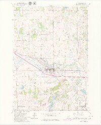
1965 Map of Melrose
USGS Topo · Published 1980About this map
The Sauk River winds through this central Stearns County landscape, anchoring a region defined by established small-town centers and diverse land uses in the mid-1960s. The city of Melrose serves as the primary hub, where the Great Northern rail line and a prominent Hospital reflect its role as a regional service point. To the south, the smaller settlements of Meire Grove and New Munich maintain distinct identities, each featuring local landmarks like St Johns Cem.
Find a feature on this map
30 named features on this map. Tap any name to fly to it.
Don’t see what you’re looking for? This feature index may not catch every label — zoom into the map to look around manually.
Map Details
Editions of this 1965 Melrose Map
3 editions found
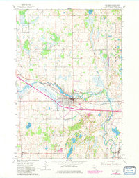
Other maps of this area

1950 · Swanville
USGS Topo · 1:62,500

1953 · Saint Cloud
USGS Topo · 1:250,000

1957 · Saint Cloud
USGS Topo · 1:250,000

1958 · Saint Cloud
USGS Topo · 1:250,000

1965 · Greenwald
USGS Topo · 1:24,000

1965 · Sauk Centre
USGS Topo · 1:24,000

1965 · Melrose
USGS Topo · 1:24,000

1965 · Freeport
USGS Topo · 1:24,000

1965 · Elrosa
USGS Topo · 1:24,000

1965 · St Martin
USGS Topo · 1:24,000
Featured Places
- Melrose, MN
- New Munich, MN
- Meire Grove, MN
- Rose Terrace Mobile Home Park, Melrose
- Melrose Mobile Home Park, Melrose