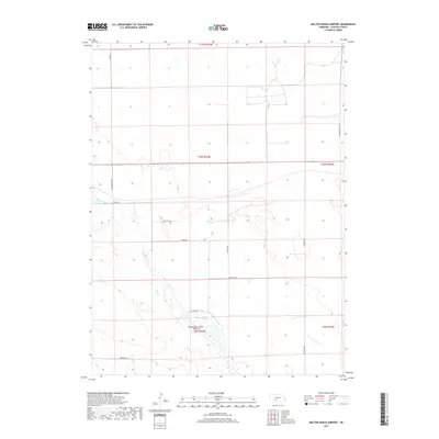
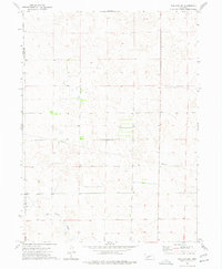
2017 Map of Melton Ranch Airport
USGS Topo · Published 2017About this map
The high plains of Lincoln County are defined here by the drainage of Red Willow Cr and the ephemeral path of Dry Cr. This rural landscape, characterized by its section-line road network, highlights the infrastructure of mid-20th century ranching and aviation. Centrally located is the Melton Ranch Airport (Historic), a reminder of the era's reliance on small private airstrips to manage the vast distances of the Nebraska interior. The local road system, including named routes such as Prairie Trace Rd, Fear Rd, and Burma Rd, follows the rigid grid of the Public Land Survey System, while smaller paths like W Creek Rd and N Wallace Rd navigate the local draws and seasonal creek beds. This document provides a record of the land use and ranching layout before modern consolidation altered many of these original property lines and private access ways.
Find a feature on this map
18 named features on this map. Tap any name to fly to it.
Don’t see what you’re looking for? This feature index may not catch every label — zoom into the map to look around manually.
Map Details
Editions of this 2017 Melton Ranch Airport Map
This is the sole edition of this map. No revisions or reprints were ever made.
Other maps of this area

1954 · McCook
USGS Topo · 1:250,000

1956 · Dickens
USGS Topo · 1:24,000

1957 · McCook
USGS Topo · 1:250,000

1958 · McCook
USGS Topo · 1:250,000
1970 · Dickens NW
USGS Topo · 1:24,000

1973 · Suttlers Canyon East
USGS Topo · 1:24,000

1973 · Suttlers Canyon West
USGS Topo · 1:24,000
1973 · Wallace NE
USGS Topo · 1:24,000
1973 · Melton Ranch Airport
USGS Topo · 1:24,000
1973 · Wallace NW
USGS Topo · 1:24,000