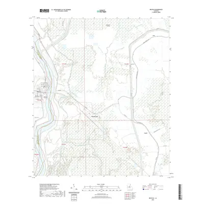
2020 Map of Melville
USGS Topo · Published 2020About this map
The Atchafalaya River defines the western edge of this landscape, carving a deep boundary between St. Landry Parish and Pointe Coupee Parish. The town of Melville sits securely behind the river levees, organized around a tight grid of streets like Landrum St and Ollie St. This area is dense with local heritage, particularly evident in the cluster of sacred sites including the Saint John the Evangelist Catholic Cem, Methodist Cem, and Episcopal Cem.
Find a feature on this map
55 named features on this map. Tap any name to fly to it.
Don’t see what you’re looking for? This feature index may not catch every label — zoom into the map to look around manually.
Map Details
Editions of this 2020 Melville Map
This is the sole edition of this map. No revisions or reprints were ever made.
Other maps of this area

1939 · Fordoche
USGS Topo · 1:62,500

1941 · Batchelor
USGS Topo · 1:62,500

1954 · Fordoche
USGS Topo · 1:24,000

1954 · Baton Rouge
USGS Topo · 1:250,000

1955 · Fordoche
USGS Topo · 1:62,500

1955 · Batchelor
USGS Topo · 1:62,500

1955 · Odenburg
USGS Topo · 1:62,500

1956 · Baton Rouge
USGS Topo · 1:250,000

1959 · Fordoche
USGS Topo · 1:62,500

1959 · Palmetto
USGS Topo · 1:62,500