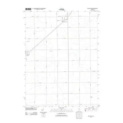
2012 Map of Melvin East
USGS Topo · Published 2012About this map
The villages of Roberts and Melvin anchor this section of Ford County, situated within a landscape of expansive Illinois farmland defined by a meticulous grid of rural roads. This 2012 survey reveals the continued importance of agricultural heritage at Kendrick Farm and the specialized transport hub at Beherns Airport. The town of Melvin is mapped in detail, showing streets like N Center St and 2nd St, along with the Melvin Cem located just to the north. Water management is a critical feature of this prairie terrain, evidenced by the channelized Big Four Ditch cutting across the southwestern corner. The map documents a classic Midwestern interior, where small-town centers are connected by long-established section lines and named routes like W Green St and N Main St.
Find a feature on this map
30 named features on this map. Tap any name to fly to it.
Don’t see what you’re looking for? This feature index may not catch every label — zoom into the map to look around manually.
Map Details
Editions of this 2012 Melvin East Map
This is the sole edition of this map. No revisions or reprints were ever made.
Other maps of this area

1924 · Paxton
USGS Topo · 1:62,500

1927 · Paxton
USGS Topo · 1:62,500

1928 · Gibson City
USGS Topo · 1:62,500

1947 · Sibley
USGS Topo · 1:62,500

1948 · Buckley
USGS Topo · 1:62,500

1949 · Buckley
USGS Topo · 1:62,500

1949 · Paxton
USGS Topo · 1:62,500

1949 · Sibley
USGS Topo · 1:62,500

1957 · Paxton
USGS Topo · 1:62,500

1957 · Gibson City
USGS Topo · 1:62,500