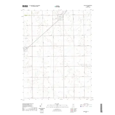
2021 Map of Melvin East
USGS Topo · Published 2021About this map
The agrarian landscape of Livingston and Ford counties is defined by a precise section-line road network, centered on the village of Roberts. This 2021 survey illustrates the modern layout of the community, where residential streets like N Locust St and W Green St meet regional connectors such as Co Hwy 22. To the southwest, the town of Melvin sits at the junction of N Center St and E 1200 North Rd, serving as another localized anchor for the surrounding farms. The preservation of local heritage is marked by the Melvin Cem and the Township Cem located near Lyman. This map provides a clear record of the enduring rural settlement patterns in this part of Illinois, from the primary thoroughfares like N 1500E Rd to the quiet corner of Lyman.
Find a feature on this map
37 named features on this map. Tap any name to fly to it.
Don’t see what you’re looking for? This feature index may not catch every label — zoom into the map to look around manually.
Map Details
Editions of this 2021 Melvin East Map
This is the sole edition of this map. No revisions or reprints were ever made.
Other maps of this area

1924 · Paxton
USGS Topo · 1:62,500

1927 · Paxton
USGS Topo · 1:62,500

1928 · Gibson City
USGS Topo · 1:62,500

1947 · Sibley
USGS Topo · 1:62,500

1948 · Buckley
USGS Topo · 1:62,500

1949 · Buckley
USGS Topo · 1:62,500

1949 · Paxton
USGS Topo · 1:62,500

1949 · Sibley
USGS Topo · 1:62,500

1957 · Paxton
USGS Topo · 1:62,500

1957 · Gibson City
USGS Topo · 1:62,500