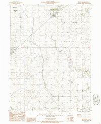
1986 Map of Melvin East
USGS Topo · Published 1986About this map
The agricultural landscape of central Illinois is defined by precise section lines and extensive drainage engineering in this mid-1980s record of Ford County. The village of Roberts serves as a primary hub in the northeast, while Melvin anchors the western edge of the sheet. The region's heavy reliance on water management is evident in the sprawling network of man-made waterways, most notably the Wall Town Ditch and the Big Four Ditch, which channel water across the townships of Lyman, Peach Orchard, and Wall. Transportation and infrastructure are represented by the Illinois Central Gulf railroad line, which cuts diagonally through the prairie. A Radio Tower and the Roberts Vortac aviation navigation aid stand as modern landmarks against the traditional rural backdrop near Germanville, providing insight into the technological layers added to this farming community during the late 20th century.
Find a feature on this map
12 named features on this map. Tap any name to fly to it.
Don’t see what you’re looking for? This feature index may not catch every label — zoom into the map to look around manually.
Map Details
Editions of this 1986 Melvin East Map
This is the sole edition of this map. No revisions or reprints were ever made.
Other maps of this area

1924 · Paxton
USGS Topo · 1:62,500

1927 · Paxton
USGS Topo · 1:62,500

1928 · Gibson City
USGS Topo · 1:62,500

1947 · Sibley
USGS Topo · 1:62,500

1948 · Buckley
USGS Topo · 1:62,500

1949 · Buckley
USGS Topo · 1:62,500

1949 · Paxton
USGS Topo · 1:62,500

1949 · Sibley
USGS Topo · 1:62,500

1957 · Paxton
USGS Topo · 1:62,500

1957 · Gibson City
USGS Topo · 1:62,500