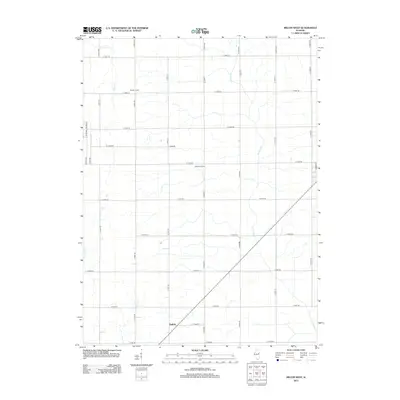
2012 Map of Melvin West
USGS Topo · Published 2012About this map
Guthrie sits at the intersection of rural rail and road networks in this corner of Ford County, surrounded by a landscape defined by industrial-scale agriculture. The rectilinear grid of the township system is clearly visible, punctuated by established agricultural operations such as Mueller Farms and Hornstein Farms. Water management is a central theme of this terrain, with the Big Four Ditch cutting a straight diagonal across the prairie to channel runoff from the surrounding fields. Older natural drainage patterns remain evident through the winding paths of Indian Cr and Drummer Cr, which contrast with the engineered precision of the local roads. This document records the rural infrastructure of the early 21st century, from named thoroughfares like Co Rd-800 Adams St to the secondary routes that link these isolated farmsteads.
Find a feature on this map
33 named features on this map. Tap any name to fly to it.
Don’t see what you’re looking for? This feature index may not catch every label — zoom into the map to look around manually.
Map Details
Editions of this 2012 Melvin West Map
This is the sole edition of this map. No revisions or reprints were ever made.
Other maps of this area

1924 · Paxton
USGS Topo · 1:62,500

1927 · Paxton
USGS Topo · 1:62,500

1928 · Gibson City
USGS Topo · 1:62,500

1947 · Sibley
USGS Topo · 1:62,500

1948 · Buckley
USGS Topo · 1:62,500

1949 · Buckley
USGS Topo · 1:62,500

1949 · Paxton
USGS Topo · 1:62,500

1949 · Sibley
USGS Topo · 1:62,500

1957 · Paxton
USGS Topo · 1:62,500

1957 · Gibson City
USGS Topo · 1:62,500