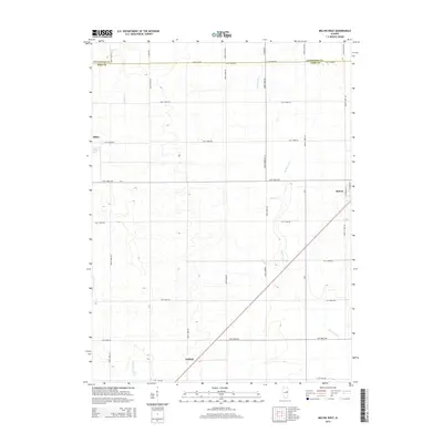
2015 Map of Melvin West
USGS Topo · Published 2015About this map
Melvin and Sibley anchor this portion of the Illinois prairie, situated along the border of Livingston and Ford counties. The landscape is defined by the highly structured grid of the Public Land Survey System, where roads like North 500E Rd and East 1300N Rd follow section lines across the flat agricultural expanse. This mid-2010s survey reveals how water management has transformed the terrain, with the Big Four Ditch cutting diagonally across the township to facilitate drainage for large-scale farming. To the south, the small settlement of Guthrie sits near the headwaters of Dickerson Slough, while Drummer Cr and Indian Cr provide the few natural curves in an otherwise rectilinear environment. The map offers a clear view of the rural infrastructure that sustains these Central Illinois communities, from the residential streets of North Green St to the remote crossroads of the surrounding farmland.
Find a feature on this map
33 named features on this map. Tap any name to fly to it.
Don’t see what you’re looking for? This feature index may not catch every label — zoom into the map to look around manually.
Map Details
Editions of this 2015 Melvin West Map
This is the sole edition of this map. No revisions or reprints were ever made.
Other maps of this area

1924 · Paxton
USGS Topo · 1:62,500

1927 · Paxton
USGS Topo · 1:62,500

1928 · Gibson City
USGS Topo · 1:62,500

1947 · Sibley
USGS Topo · 1:62,500

1948 · Buckley
USGS Topo · 1:62,500

1949 · Buckley
USGS Topo · 1:62,500

1949 · Paxton
USGS Topo · 1:62,500

1949 · Sibley
USGS Topo · 1:62,500

1957 · Paxton
USGS Topo · 1:62,500

1957 · Gibson City
USGS Topo · 1:62,500