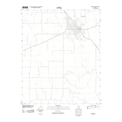
2010 Map of Memphis
USGS Topo · Published 2010About this map
Memphis serves as the focal point of this Hall County landscape, situated where several regional routes and rail lines converge. The town's grid is bounded by the winding paths of Berkley Creek and Parker Creek, which drain the surrounding plains. To the north, the Memphis Municipal Airport sits along the roadway that leads toward Jonah Creek. The topography is defined by a series of intermittent streams and draws, including the lengthy course of Indian Creek that meanders through the western portion of the quadrangle. This 2010 survey reflects a stabilized agricultural landscape where a dense network of county roads like Co RD A and Co RD 21 provides access to the expansive rural acreage outside the city limits. The map captures the interface between the structured town environment and the natural drainage systems of the Texas Panhandle.
Find a feature on this map
22 named features on this map. Tap any name to fly to it.
Don’t see what you’re looking for? This feature index may not catch every label — zoom into the map to look around manually.
Map Details
Editions of this 2010 Memphis Map
This is the sole edition of this map. No revisions or reprints were ever made.
Other maps of this area

1954 · Plainview
USGS Topo · 1:250,000

1958 · Plainview
USGS Topo · 1:250,000

1961 · Memphis
USGS Topo · 1:62,500

1961 · Estelline
USGS Topo · 1:62,500

1963 · Hedley
USGS Topo · 1:24,000

1963 · Giles
USGS Topo · 1:24,000

1964 · Rolla SW
USGS Topo · 1:24,000

1976 · Memphis NW
USGS Topo · 1:24,000

1976 · Memphis SE
USGS Topo · 1:24,000

1976 · Memphis NE
USGS Topo · 1:24,000