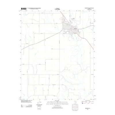
2012 Map of Memphis
USGS Topo · Published 2012About this map
Memphis serves as the primary hub of this Texas Panhandle landscape, where a dense residential grid meets the surrounding agricultural expanse. The town's layout is defined by its numbered street system, including N 20th St and Main St, with the Memphis Municipal Airport situated to the northeast. This 2012 survey illustrates a region shaped by its water sources and rural infrastructure, from the flowing Parker Cr and Indian Cr to the localized Milam Spring. The terrain is partitioned by an extensive network of county roads such as CO Road A and CO Road G, reflecting the enduring grid of West Texas land management. Traces of historical geography are visible in the winding paths of Jonah Cr and Berkley Cr, which cut through the rectilinear farm blocks and ranch lands that dominate the territory south of the town center.
Find a feature on this map
57 named features on this map. Tap any name to fly to it.
Don’t see what you’re looking for? This feature index may not catch every label — zoom into the map to look around manually.
Map Details
Editions of this 2012 Memphis Map
This is the sole edition of this map. No revisions or reprints were ever made.
Other maps of this area

1954 · Plainview
USGS Topo · 1:250,000

1958 · Plainview
USGS Topo · 1:250,000

1961 · Memphis
USGS Topo · 1:62,500

1961 · Estelline
USGS Topo · 1:62,500

1963 · Hedley
USGS Topo · 1:24,000

1963 · Giles
USGS Topo · 1:24,000

1964 · Rolla SW
USGS Topo · 1:24,000

1976 · Memphis NW
USGS Topo · 1:24,000

1976 · Memphis SE
USGS Topo · 1:24,000

1976 · Memphis NE
USGS Topo · 1:24,000