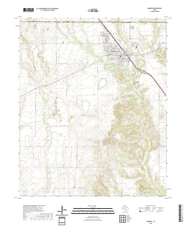
2022 Map of Memphis
USGS Topo · Published 2022About this map
Memphis serves as the focal point of this Panhandle landscape, where the street grid of the county seat meets the drainage networks of the Red River valley. The Hall County Courthouse stands at the center of the town's civic life, surrounded by neighborhood streets such as Grundy St and W Noel St. Beyond the settled area, the terrain is defined by a series of north-south waterways including Indian Cr, Berkley Cr, and Parker Cr, which carve through the plains. For genealogists and local historians, the proximity of Fairview Cem and Old Fairview Cem northeast of the city center provides specific points for tracing the area's residents. The map also documents the transportation infrastructure, from the Memphis Municipal Airport to the rural farm-to-market roads and county routes that connect the scattered agricultural lands of Hall, Donley, and Collingsworth counties.
Find a feature on this map
66 named features on this map. Tap any name to fly to it.
Don’t see what you’re looking for? This feature index may not catch every label — zoom into the map to look around manually.
Map Details
Editions of this 2022 Memphis Map
This is the sole edition of this map. No revisions or reprints were ever made.
Other maps of this area

1954 · Plainview
USGS Topo · 1:250,000

1958 · Plainview
USGS Topo · 1:250,000

1961 · Memphis
USGS Topo · 1:62,500

1961 · Estelline
USGS Topo · 1:62,500

1963 · Hedley
USGS Topo · 1:24,000

1963 · Giles
USGS Topo · 1:24,000

1964 · Rolla SW
USGS Topo · 1:24,000

1976 · Memphis NW
USGS Topo · 1:24,000

1976 · Memphis SE
USGS Topo · 1:24,000

1976 · Memphis NE
USGS Topo · 1:24,000