
1976 Map of Memphis SE
USGS Topo · Published 1978About this map
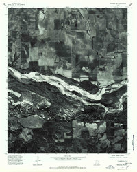
The braided channels of the Prairie Dog Town Fork Red River dominate this 1976 orthophotograph of southeastern Hall County. This specialized imagery, prepared from aerial photographs by the U.S. Geological Survey, reveals the intricate sandbars and shifting hydrology of the Texas Panhandle landscape. In the southern portion of the sheet, the Little Red River flows toward its confluence, bordered by the small agricultural communities of Parnell and Hulver. The contrast between the broad, sandy riverbed and the surrounding organized grid of farm plots illustrates the region's reliance on irrigation and specific land-use patterns during the mid-1970s. For those researching local history, the map provides a clear record of rural road networks and field boundaries as they existed nearly fifty years ago, long before more recent changes in land management or environmental shifts.
Find a feature on this map
4 named features on this map. Tap any name to fly to it.
Don’t see what you’re looking for? This feature index may not catch every label — zoom into the map to look around manually.
Map Details
Editions of this 1976 Memphis SE Map
This is the sole edition of this map. No revisions or reprints were ever made.
Other maps of this area

1954 · Plainview
USGS Topo · 1:250,000

1958 · Plainview
USGS Topo · 1:250,000

1961 · Memphis
USGS Topo · 1:62,500

1961 · Estelline
USGS Topo · 1:62,500

1967 · Tell North
USGS Topo · 1:24,000

1967 · Badger Nest Tank
USGS Topo · 1:24,000

1967 · Blue Tank Canyon
USGS Topo · 1:24,000

1976 · Memphis NW
USGS Topo · 1:24,000

1976 · Memphis NE
USGS Topo · 1:24,000
1976 · Memphis SW
USGS Topo · 1:24,000