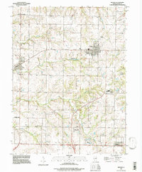
1995 Map of Mendon
USGS Topo · Published 1998About this map
Mendon serves as a central hub for this portion of Adams County, surrounded by a rural landscape defined by several family and community burial grounds. Genealogists can trace local heritage through sites like Keith Cem, Franklin Cem, and Booth Cem, or the New Providence Ch and its associated New Providence Cem. The drainage patterns of the region are shaped by the winding courses of Bear Creek, Honey Creek, and Frazier Creek, which cut through the agricultural terrain. The map records several small communities and crossroads such as Marcelline, Ursa, Bloomfield, and Fowler. Notable landmarks of the mid-1990s include the County Fairground east of Mendon and the Cramm Landing Strip, alongside infrastructure like the Sewage Disposal Ponds and a prominent Pipeline traversing the southern townships.
Find a feature on this map
43 named features on this map. Tap any name to fly to it.
Don’t see what you’re looking for? This feature index may not catch every label — zoom into the map to look around manually.
Map Details
Editions of this 1995 Mendon Map
This is the sole edition of this map. No revisions or reprints were ever made.
Other maps of this area

1925 · Quincy
USGS Topo · 1:62,500

1925 · Liberty
USGS Topo · 1:62,500

1927 · Liberty
USGS Topo · 1:62,500

1944 · Quincy
USGS Topo · 1:62,500

1945 · Quincy
USGS Topo · 1:62,500

1946 · Mendon
USGS Topo · 1:62,500

1948 · Quincy
USGS Topo · 1:250,000

1948 · Mendon
USGS Topo · 1:62,500

1948 · Camp Point
USGS Topo · 1:62,500

1956 · Quincy
USGS Topo · 1:250,000