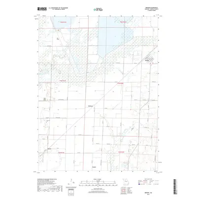
2017 Map of Mendon
USGS Topo · Published 2017About this map
Mendon serves as the primary population center in this part of Chariton County, characterized by a distinct grid of streets including Commercial St and Wood St. The surrounding landscape is defined by the hydrologic network of Yellow Cr and Elk Cr, which feed into several wetland areas and small bodies of water like S Lake and Craddock Lake. The terrain is generally low-lying, with Hog Ridge providing a rare point of elevation amidst the expansive drainage basins of Salt Cr and Hickory Br.
Find a feature on this map
60 named features on this map. Tap any name to fly to it.
Don’t see what you’re looking for? This feature index may not catch every label — zoom into the map to look around manually.
Map Details
Editions of this 2017 Mendon Map
This is the sole edition of this map. No revisions or reprints were ever made.
Other maps of this area

1890 · Marshall
USGS Topo · 1:125,000

1892 · Marshall
USGS Topo · 1:125,000

1901 · Marshall
USGS Topo · 1:125,000

1924 · Hale
USGS Topo · 1:62,500

1949 · Mendon
USGS Topo · 1:24,000

1949 · Indian Grove
USGS Topo · 1:24,000

1949 · Sumner
USGS Topo · 1:24,000

1949 · Rothville
USGS Topo · 1:24,000

1950 · Sumner
USGS Topo · 1:24,000

1950 · Rothville
USGS Topo · 1:24,000